Hello, I'm Yina.
I'm currently a Thouron Scholar at University College London where I'm pursuing my Master's in Geospatial Data Science. I previously studied Economics and Statistics at University of Pennsylvania.
I'm interested in developing data workflows to better understand society and storytelling through data visualization. I'm also fascinated by all things spatio-temporal -- IoTs, data-driven planning, computer vision, causal inference, agent-based modeling and mapping and enjoy climate and urban research.
In my freetime, I enjoy solo-traveling. I've visited 100+ countries. I also enjoy playing the flute, hiking, and learning new languages.
Technical Skills: Python | R | SQL | Javascript | Machine Learning | Deep Learning Keras/Tensorflow & Pytorch | Linux | Git | RESTful APIs | Tableau | QGIS | HTML/CSS/Bootstrap | Node.js
My Portfolio
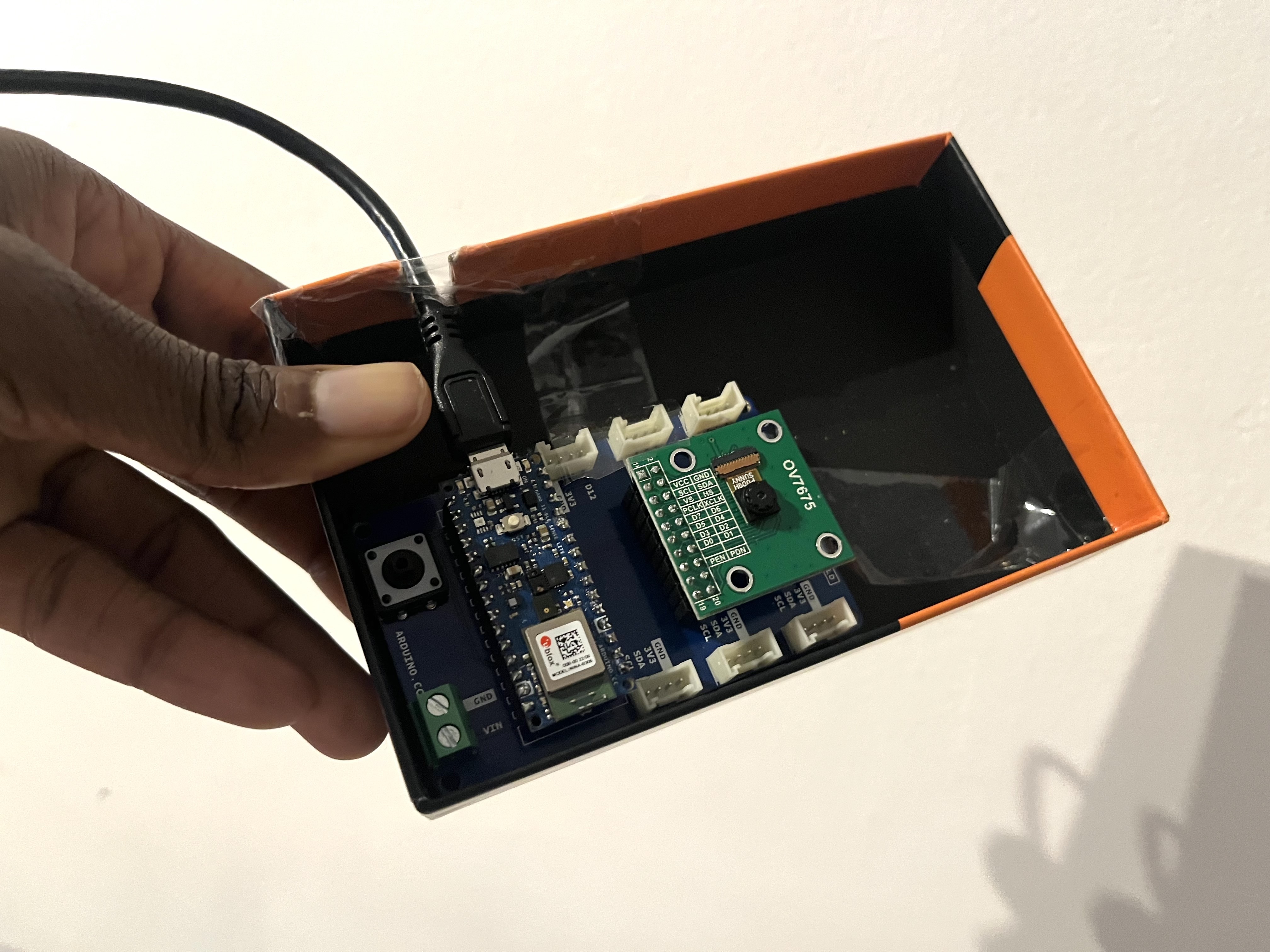
Household Mold Detector
TensorflowLite | Python/C++| Arduino | Deep Learning | Computer Vision
Using Transfer Learning, I create and deploy a model on an Arduino device with a OV7675 camera. The device's light turns turns blue when capturing an image, red when it detects mold or green in the absence of mold.

Classifying Forest Fires Using Aerial Imagery
Python | ML | Deep Learning
Using remote sensing, I classified images taken during a forest fire and attempted to use an autoencoder for dimensionality reduction. My final CNN had an accuracy of 96%.
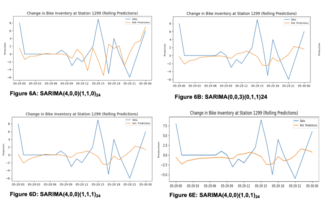
Predicting Bike Share Demand in Chattanooga
Python | Times Series | ML | RNN
I forecast bike share demand in the City of Chattanooga, specifically the change in bike inventory at every hour at popular bike dock stations using SARIMA, VAR, Random Forest and LSTM.
Opioid Overdose Risk Modelling
R | Geocomputation
My team used a variety of spatial regression models to identify the relationship between potential risk factors and overdose deaths in Mesa, AZ.
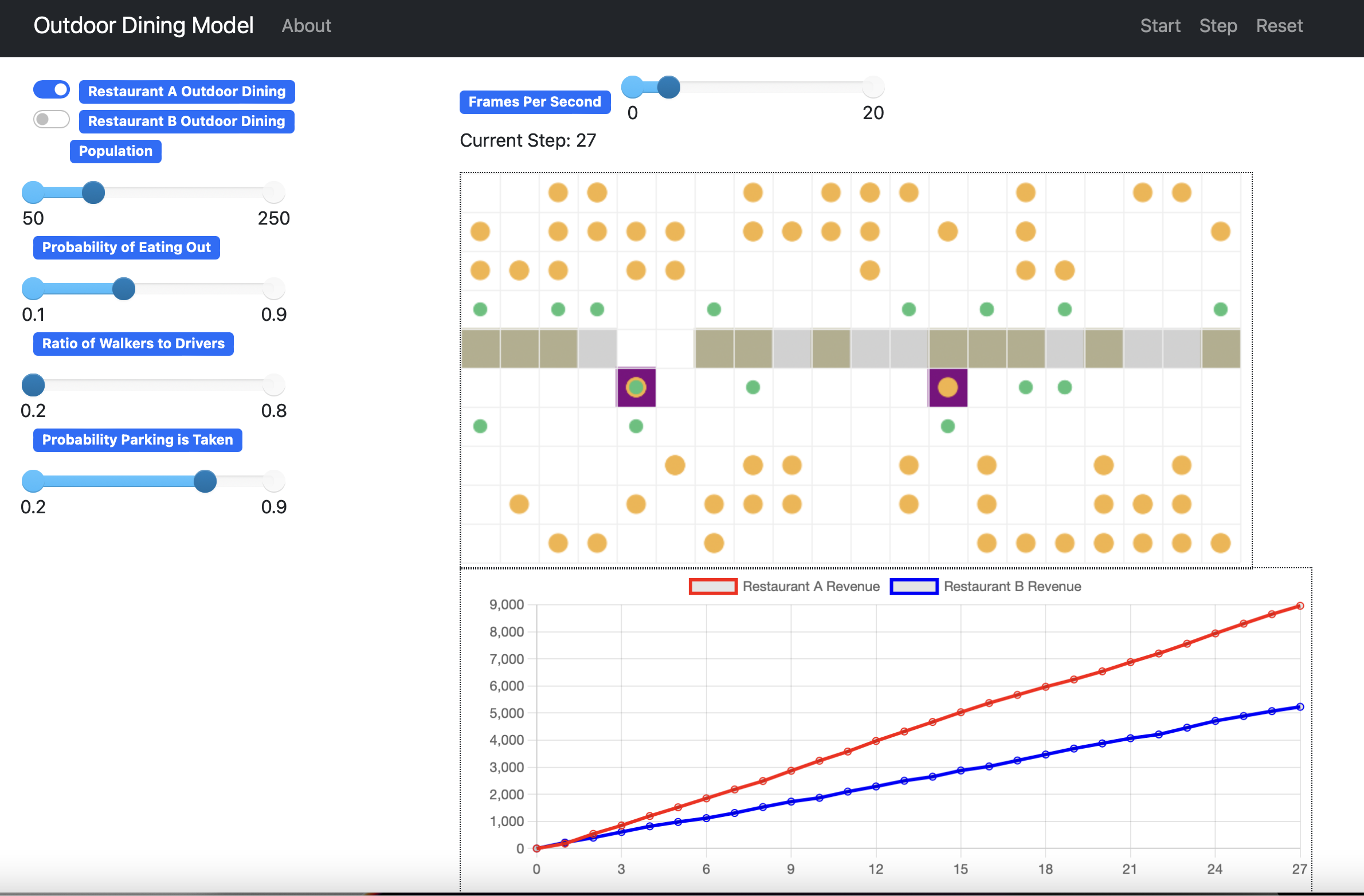
Agent Based Modelling of Outdoor Restaurant Seating Choices
OOP | Python | Mesa
I made an agent-based model simulating the revenues of restaurants based on their decision to implement outdoor dining using Mesa in Python.
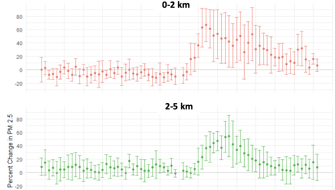
Characterizing Structural Fires with a Low-Cost Dense Sensing Network
Python | R | SQL | Econometrics
Interning at Microsoft Research, I ideated and conducted an empirical study utilizing Project Eclipse's novel network of hyperlocal sensors to identify the spatial and temporal causal effect of house fires on pollution. Published in Nature Scientific Reports
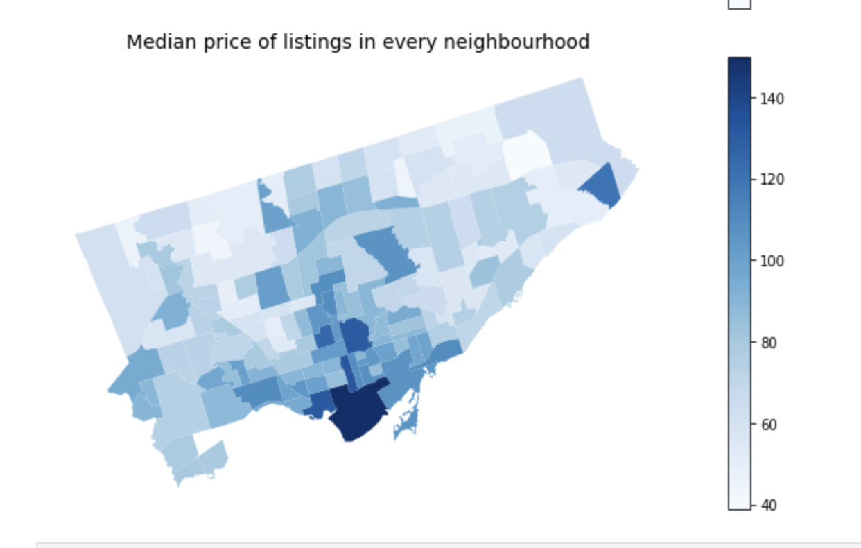
Toronto Airbnb Pricing Model
Python
My team explored and mapped data on Airbnb prices in Toronto. Using statistical regression analysis, we investigated the relationship between amenities, location, property type etc. and pricing.
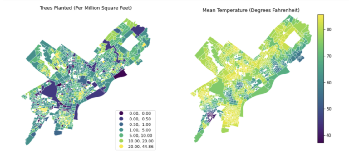
Who Gets Green in Philadelphia?
Python | R | Google Earth | Geocomputation
I conducted a socio-spatial analysis of the equity of Philadelphia's tree ditribution program using spatial regression models. I utilized satellite imagery using the Google Earth API in Python to identify urban heat islands and used the US Census API for demographic data.
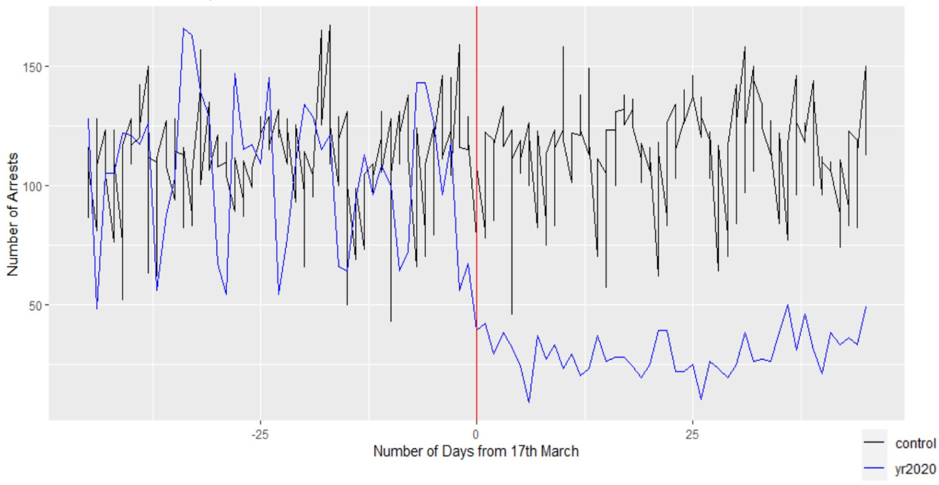
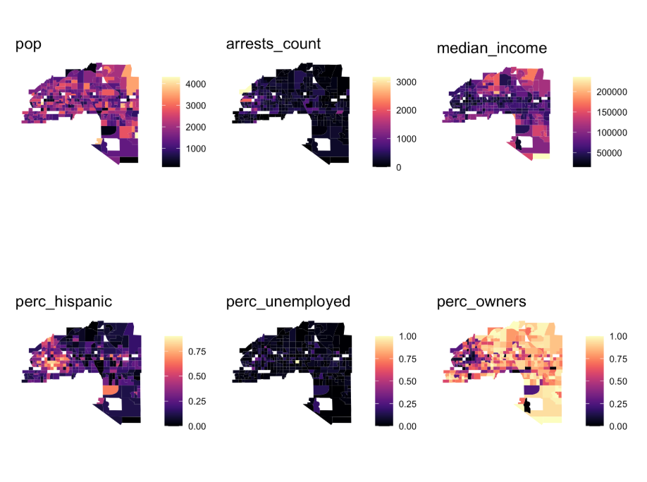
Effect of COVID Shutdowns on Policing in Philadelphia
R | Econometrics
I conducted a natural experiment to find the causal effect of COVID-19 Policy changes on arrests in Philadelphia. I investigated the changes in arrests for petty crimes before an after the March 17 Police Memo in comparison to arrests in previous years.
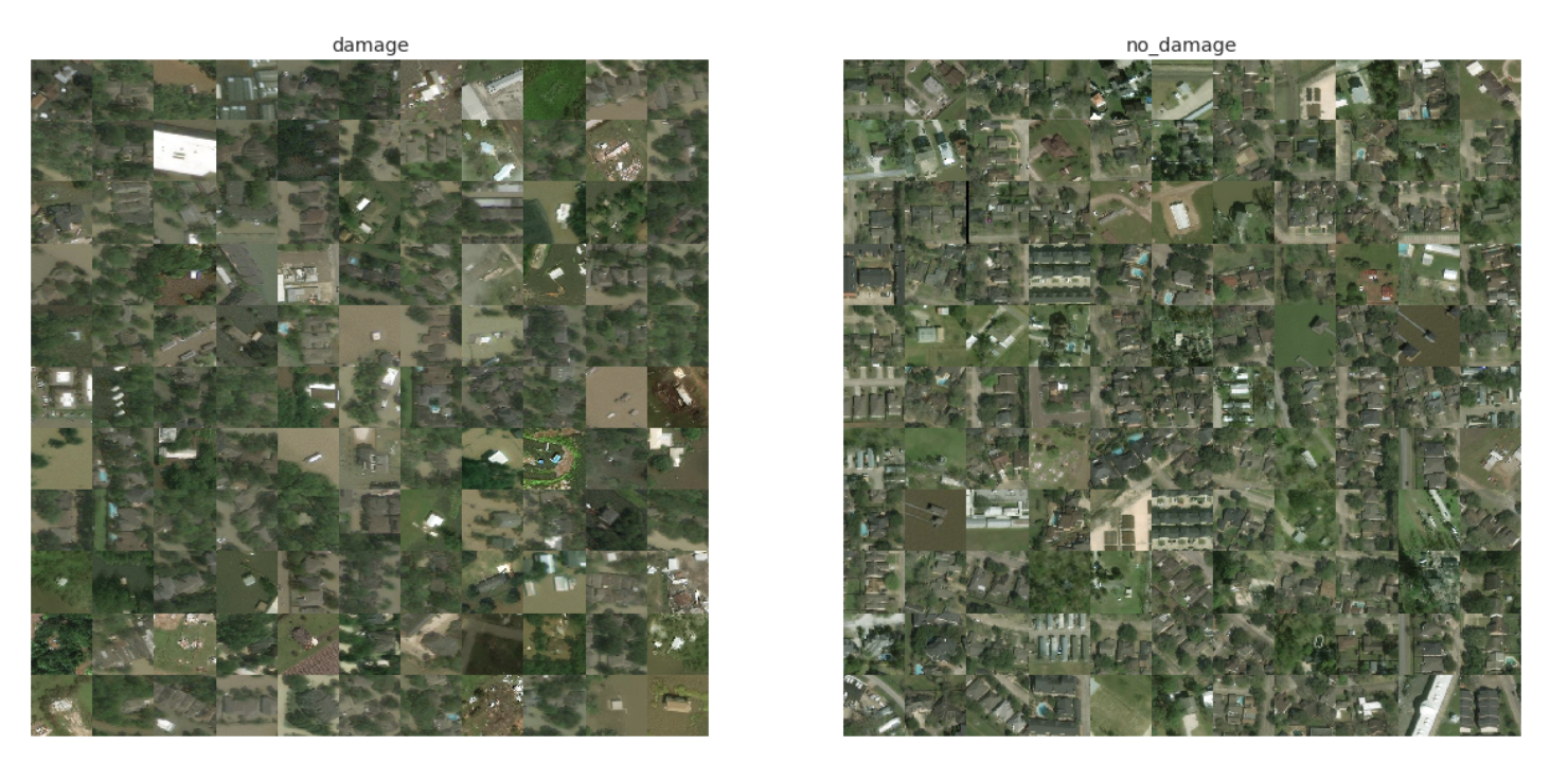
Detecting Damaged Buildings after Hurricane from Satellite Imagery
Python | Machine Learning
I used a variety of machine learning algorithms with hyperparameter tuning and nested cross validation to develop a suitable model classifying satellite images based on if they contained an building damaged by a hurricane.
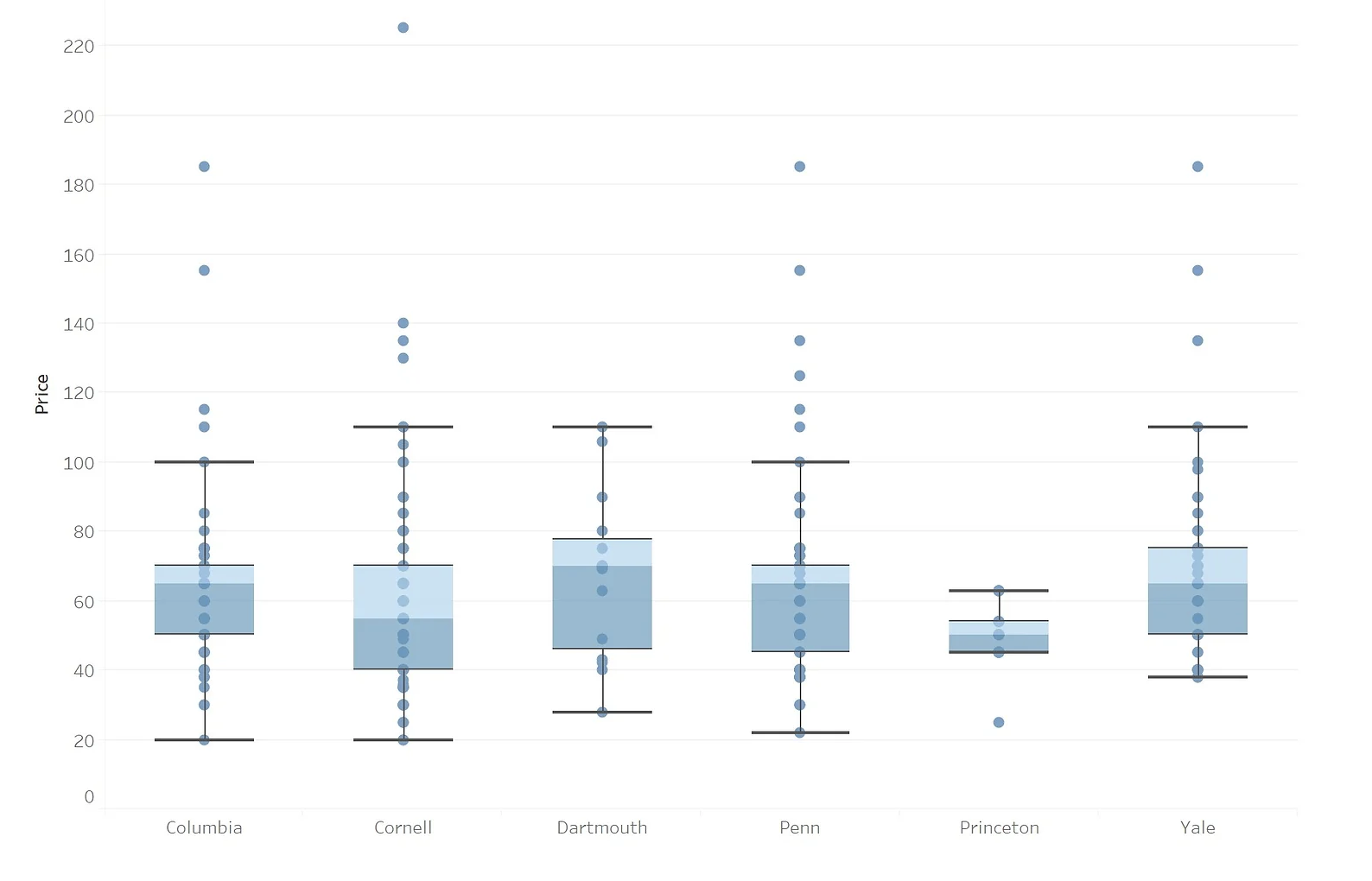
The Best Deal for University Apparel
Tableau | Web Scraping
In this project, I scraped the websites of the merchandise stores from all the Ivy Leagues and collected data from various athletic stores to conduct analysis on the quality of deals offered at the UPenn Bookstore. My results are presented in a website I shared with new Penn admits.
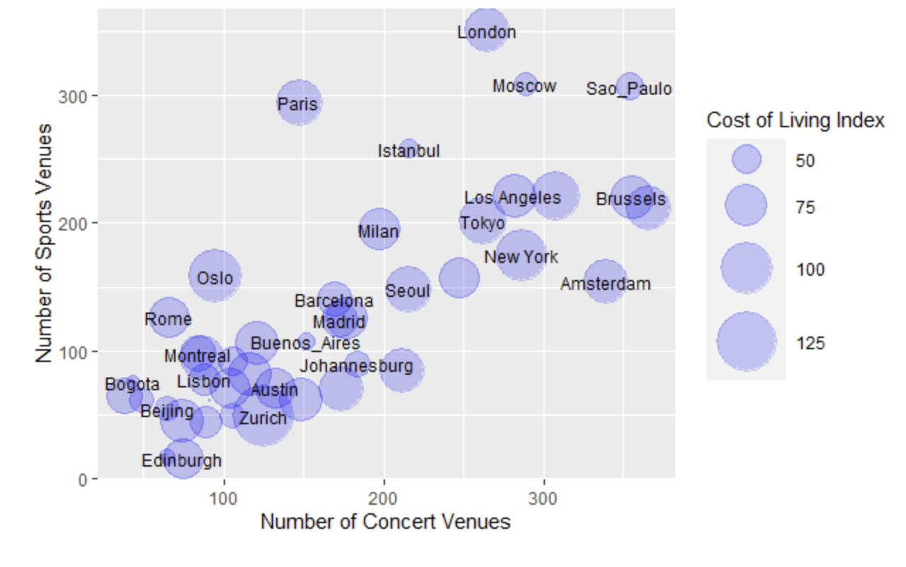
What City is Best For You?
R | Web Scraping
I collected information from Numbeo, TomTom, World Culture Forum and Teleport to conduct a fun data exploration in R comparing cities around the world based on their amnities, cost of living, salaries, pollution and tolerance.